3D Model of Mason Dixon Meteor
by Mike Hankey, under Mason Dixon Meteor
Since the begining of this adventure I have wanted to share all of the information I have about the meteor event and the possible where abouts of the meteorites. A lot of very brilliant people have worked hard to aquire and analyze all of the data used to project the path and determine the impact point and the possible strewn field location. Rob Matson a scientist and meteorite enthusist compiled and analyzed the data and wrote a computer program in Fortran to create a 3D model of the Mason Dixon Meteor. Rob has been sharing his data with me for a few weeks now and I asked him yesterday if it would be ok to make the information public. He agreed that making all of the information publicly available would greatly increase the chances of recovering the meteorites.
I would like to express my sincere gratitude and thanks to all of the people that worked hard to help Rob develop this model including: Marc Fries, Dirk Ross, Elton Jones, Steve Arnold, Ruben Garcia, Eric Whicman, Mike Antonelli, Derik Bower, John Divelbiss, Safe Harbor Power Corp, York Water Company, Alison Kruse and everyone else that helped with this (lmk if I forgot about you and I’ll add you to the list).
Rob wanted me to make it clear that this data is an estimate based on the reports and analysis of the cameras and angles that captured the meteor. His 3d model is only as good as the field reports and data going in. Despite this disclaimer, Rob feels very confident about the model and his location and angle is consistent with numerous eye witness reports. In his words:
You have my okay on it. I would reiterate Marc’s comments that my modeling predictions are only as good as the information that goes into them. But that said, the current information is unusually good for a fireball; in particularly, I don’t know of any previous bolide that was serendipitously observed by a telescope.
Here is a Google Earth movie that illustrates the Mason Dixon Meteor’s 3D model.
Here are the coordinates Rob came up with for his model:
Latitude Longitude Alt
——– ——— —–
39.29389 -76.53562 100.0
39.37501 -76.49368 90.0
39.45649 -76.45145 80.0
39.53833 -76.40893 70.0
39.62054 -76.36610 60.0
39.70311 -76.32297 50.0
39.78606 -76.27954 40.0
39.86938 -76.23580 30.0
39.95307 -76.19174 20.0
40.03714 -76.14737 10.0
40.12160 -76.10268 0.0
I will be posting detailed search maps as well as Marc Fries proposed strewn field map in the days to come.
4 Comments for this entry
-
Welcome to Mike's Astro Photos!
Thanks for dropping by! Feel free to join the discussion by leaving comments, and if you want to stay updated bookmark the site, subscribe to the RSS feed, or like us on facebook.
If you think you've found a meteorite, want to go meteorite hunting have a question about astronomy, meteors, meteorites or just want to say hi, please send email to mike.hankey [AT] gmail.com
-
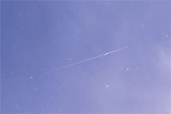
Mason Dixon Meteor Picture
Best Posts
Here are some of our best photos.
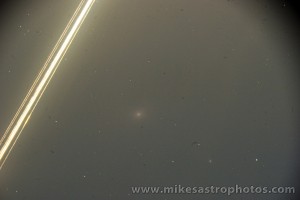
Quandrantids Fireball - 2011
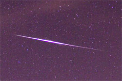
Persied Fireballs - 2011
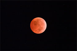
Lunar Eclipse - 2010

American Eagle - 2010

August 9th, 2009 on 11:56 pm
Nice job. That’s really cool. If only those Amish farmers could see this website. If only there were a way to x-ray corn fields from 5000 feet.
August 10th, 2009 on 2:29 am
Great Job Mike and All!
Special thanks to Rob Mason!!! Best Always in LIFE, Dirk Ross…Tokyo
August 10th, 2009 on 10:56 am
I highly recommend searching for a meteorite from this fireball for two possible locations…1) one with all the info you have in determining a possible landing place and the other 2) using all the data you have minus what was determined from the telescope photograph. I would then lean my efforts on a location determined by door #2. I’d use door #1 only after I have exhausted all my efforts with door #2. :O)
George Zay
August 10th, 2009 on 11:57 am
I have passed your comments on to the scientists that are working on the trajectory. I’ll let you know what they say.