Orange Zone Map
by Mike Hankey, under Mason Dixon Meteor
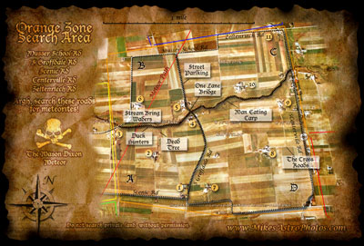
Here is the second map in a series of five — The Orange Zone.
The Orange Zone is special because it contains three markers from Marc Fries strewn field map. These markers should not be intended to be an x-marks the spot indicator (trust me I’ve been to them already). They are simply a calculated estimate based on lots of assumptions. They indicate an area where these sized meteorites would be found (if they existed in the first place) and all assumptions were true. With that being said the markers are:
- Dead Tree = 10,000g
- Man Eating Carp = 1,000g
- Cross Roads = 100g
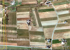
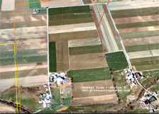
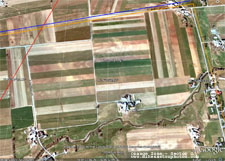
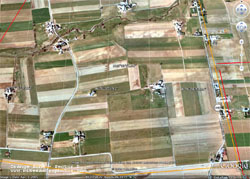
Here are the high zoom maps for the four sub sections.
There is a stream that runs through the middle of the orange zone. In sector A, I saw a big black rock sitting in the middle of the stream. I’m going to walmart to get some black waders before my next outing. I must admit I have already pulled a 30lb black rock out of the stream, turn out to be terrestrial (no I didn’t bring it home with me).
I recommend printing all of the maps and drawing on them with a pen or pencil. Shade in areas you’ve searched. Write notes on the back about land owners and number the notes to the keyed houses on the master maps. I’ve noticed the farmers really love to see their properties on these maps. Use the zoomed in satellite sector maps when talking to the farmers, I’m not sure how they would interpret the skull and cross bones on the pirate maps… Its a little scary ![]()
If you are serious about searching and talking with the landowners email me (mike.hankey [AT] gmail.com) and I can give you some tips and set you up with some information packets and other things.
Most of these roads have not been thoroughly searched. If you don’t want to deal with asking for permission, check the ditches and grass on the sides of roads.


August 20th, 2009 on 12:39 am
Move out of the way mere Meteorite Men, for here comes Mike Hankey and his Meteorite Maniacs!