Lorton Meteorite – Estimated Strewnfield version 1
by Mike Hankey, under Comets & Meteors, Misc
Aerospace engineer and meteor scientist Rob Matson has taken a first crack at an estimated strewnfield for the Lorton meteorite. Since no video of the event has yet been released, Rob used multiple witness reports, radar data, the hammer stone location and wind speed information to plot the possible locations for other meteorites from this fall. Rob has stressed the importance of searching within a 1 mile radius of the Dr’s office first but has provided this additional information should those search areas become exhausted. One should not interpret these coordinates in an x-marks-the-spot type of way. They should serve more as a general guide to areas where different sized stones would be if they existed. The strategy Rob suggested was drawing a line between the dots and covering those areas, but only after exhausting the areas around the Dr’s office.
Here is a map of the coordinates plotted in Google Earth.

Lorton Meteorite - Estimated Strewnfield v1
Here is a copy of the Google Earth KMZ file for the Lorton Meteorite Estimated Strewnfield. You will need Google Earth installed on your computer in order to view this file.
Here are the raw data coordinates for the various masses:
Mass Longitude Latitude Dist (mi) Bearing
——- ——— ——– ——— ——-
3 g -77.12929 38.73888 5.2 59.3
5 g -77.14419 38.73268 4.3 58.7
15 g -77.16179 38.72688 3.2 56.0
40 g -77.18079 38.71908 2.1 52.6
120 g -77.19569 38.71088 1.1 50.6
(308 g) -77.21159 38.70068 -0- N/A
1150 g -77.22609 38.69048 1.1 228.0
3750 g -77.24249 38.67848 2.3 227.4
It looks like one of the points is on the driving range of the Fort Belvoir Golf Course. That would be a nice easy place to search if you had access.

Meteorite Hunting on Fort Belvoir Golf Course
There have been no new discoveries reported.
If you are a local resident in the Lorton area you are encouraged to be on the lookout for meteorites. Should you find one, please record the exact location where it was found and contact me at mike.hankey [AT] gmail.com
-
Welcome to Mike's Astro Photos!
Thanks for dropping by! Feel free to join the discussion by leaving comments, and if you want to stay updated bookmark the site, subscribe to the RSS feed, or like us on facebook.
If you think you've found a meteorite, want to go meteorite hunting have a question about astronomy, meteors, meteorites or just want to say hi, please send email to mike.hankey [AT] gmail.com
-
Mason Dixon Meteor Picture
Best Posts
Here are some of our best photos.
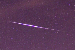
Quandrantids Fireball - 2011
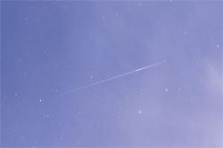
Persied Fireballs - 2011
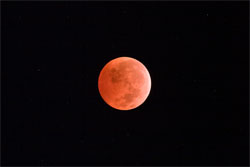
Lunar Eclipse - 2010
American Eagle - 2010