Tag: safe harbor
Safe Harbor Update
by Mike Hankey, under Mason Dixon Meteor
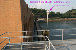
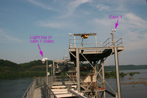
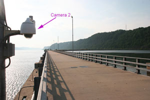
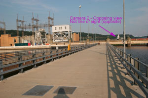
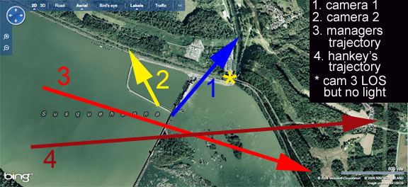
I went out to the Safe Harbor Dam again today and met with the facilities manager. He didn’t want his name mentioned so we will just call him Bob. I picked up the video on DVD Saturday and Bob wasn’t there as he started his vacation that Friday. He emailed me today and said if I brought a thumb drive with me he could give me a better quality video. I met him at the dam at 6:00 PM and we talked about the video, where the cameras were and what he thought the meteor path would have been based on his knowledge of the plant and video. I was way off on my original observations and subsequent conclusions. When I first viewed the video and surveyed the site, I believed the cameras were in certain places when in reality they were in totally different places. So Bob helped me out big time understanding the layout of the dam and the path this meteor took when it passed by. He also came into the office while he was on his vacation and worked with me for over an hour. Thanks so much Bob!
Here is the video. I have edited the footage to include slow motion view, images of the site and the line of site and meteor path projections map. Watch the whole thing, the best images are at the end.
Important note about time in video (1:04:45): I talked to Bob about the clocks in his videos and asked if they were on time. He was adamant that the clocks were perfect time as this is required because they are a federal organization.
Here are the two full length un-edited videos. They are both about 1 minute long. Cam 1 event happens about halfway through. Cam 2 event happens in the beginning.
Cam 1 Full Length Highest Res Possible
Cam 2 Full Length Highest Res Possible
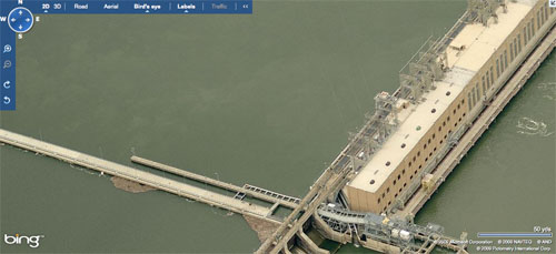
For easy reference here are some of the pictures used in the video:
Click Picture Below For Bing Maps View
Check out Microsoft’s Bing for bird’s eye views of Safe Harbor. Bing Maps is so money. The satellite images are much higher quality and more current than any other earth software out there. Plus birds eye view is SICK!
Click Picture Below For Bing Maps birds eye view
A lot of other stuff has happened today. I have much to report from the field dealing with crazy angry people to pleasant helpful Amish farmers. I also have lots of news from the NASA source but I have to keep that under wraps for a little while still (sorry). Its late, I will post again tomorrow.
